Dear Friends,
Green Valley Trekking Club is happy to announce one night-one day trek programme at Hanumantgad-Dher Khadak, Dangs-Maharashtra Border near Chinchali village on 29-30th November 2014 (Saturday night-Sunday). Interested persons may come and join with us.
Details are:
DATE : 29(Night) & 30/11/2014 (Saturday night-Sunday)
TIME : 18:00 hrs of 29th to 18:00 hrs of 30th November.
PLACE : Hanumatgad-Dher Khadak near Chinchali village(Dangs-Maharashtra Border).
Meeting Point: Near Janak Smarak Hospital Petrol Pump, Dhulia Road, Vyara at 18:30 Hrs Saturday Evening (If you do not want to come by night then can join us at Shabaridham on Sunday at 06:30 hrs morning also).
EXPECTED EXPENSE: Own vehicle and food/water.
ITMES TO BE TAKEN : Own Packed dinner for Saturday night with Tiffin box for packed lunch on Sunday, Water-2 bottles of 1 liter each, Trekking bag, Sleeping gear for Night halt at Shabaridham, Protection for cold weather, Cap or Hat, Good quality Trekking shoes, I-card, Pen, Diary, Chocolates, Medicines generally you take, Camera or Binocular if you have, chewing gum, some ready to eat food.
PURPOSE: To increase love for nature, team spirit and outdoor recreation activity.
PARTICIPATION: This event is for all nature lovers. No limit for participants.
Please inform your confirmation for the trek till Friday Evening (28/11/2014 till 18:00 hrs) to Jagdish Jadav (9428822351, 9879503706) or Sanjay Modi (9427158262). Vehicle can be arranged for those who do not have one.
PROGRAMME DETAILS:
29/11/2014:
Reach meeting point Near Janak Smarak Hospital Petrol Pump, Dhulia Road, Vyara by 18:30 Hrs. Friends from Surat/Bardoli/Vyara can meet up here and join with us.
Leave Vyara by 18:45 hrs sharp.
Reach Shabaridham by 20:30 hrs and have a dinner which you have brought.
Introduction Camp fire at 21:30 hrs.
Star Gazing / Star trail photography at 23:30 hrs at nearby place (those who are interested, or may go for sleep).
30/11/2014:
Wake-up bell at 06:00 hours, get ready by 06:30 and have a breakfast.
Have a packed lunch/food and start for Nakata Hanuvant (Base village) at 07:00 hrs sharp with packed lunch/food.
Reach hanuvantgad by 08:00 hrs and start trek to Hanumantgad by 08:30 hrs and reach atop by 10:30 hrs.
Explore the hill at the hill top and enjoy the panorama.
Start descend by 11:00 hours and climb adjoining Dher Khadak. Reach top of the hill by 12:30 hrs.
Start descend by 13:00 hrs and reach base village (Nakatia Hanuvant) by 14:30 hrs. Have a packed lunch/food.
Rest of 30 minutes and start for back journey by 15:00 hrs.
Have a tea-breakfast on the way.
Reach Vyara by 18:00 hrs.
RULES & REGULATION:
Due precautions are to be taken by all the individuals, the ultimate responsibility lies on you.
Permission from Office and Home is must.
Please wear shoes, as it is more preferable. Also 1/2 or 1/3 pents/bermudas and sleeveless t-shirts are not advised.
This is an eco-friendly trek. So, any activity against nature is prohibited. Do not litter plastic waste any where.
Always be in a group and follow group leader’s instruction.
Deviation from the trek is not permitted.
Do not over-take and avoid shortcuts while trekking.
Swimming in river is strictly prohibited.
Regards,
Jagdish Jadav / Sanjay Modi
for GVTC
"Remember Trekking is not a Picnic". Trekking is:
- A Royal fashion to meet and face the difficulties.
- Team Work Development.
- Will-power and Concentration Development.
- Maintain Fitness.
- Refreshment from Day-to-Day work.
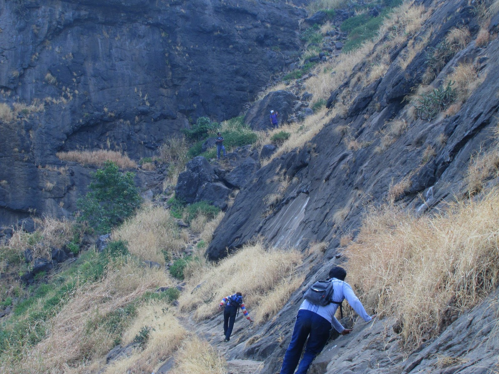
Some Pics...


Green Valley Trekking Club is happy to announce one night-one day trek programme at Hanumantgad-Dher Khadak, Dangs-Maharashtra Border near Chinchali village on 29-30th November 2014 (Saturday night-Sunday). Interested persons may come and join with us.
Details are:
DATE : 29(Night) & 30/11/2014 (Saturday night-Sunday)
TIME : 18:00 hrs of 29th to 18:00 hrs of 30th November.
PLACE : Hanumatgad-Dher Khadak near Chinchali village(Dangs-Maharashtra Border).
Meeting Point: Near Janak Smarak Hospital Petrol Pump, Dhulia Road, Vyara at 18:30 Hrs Saturday Evening (If you do not want to come by night then can join us at Shabaridham on Sunday at 06:30 hrs morning also).
EXPECTED EXPENSE: Own vehicle and food/water.
ITMES TO BE TAKEN : Own Packed dinner for Saturday night with Tiffin box for packed lunch on Sunday, Water-2 bottles of 1 liter each, Trekking bag, Sleeping gear for Night halt at Shabaridham, Protection for cold weather, Cap or Hat, Good quality Trekking shoes, I-card, Pen, Diary, Chocolates, Medicines generally you take, Camera or Binocular if you have, chewing gum, some ready to eat food.
PURPOSE: To increase love for nature, team spirit and outdoor recreation activity.
PARTICIPATION: This event is for all nature lovers. No limit for participants.
Please inform your confirmation for the trek till Friday Evening (28/11/2014 till 18:00 hrs) to Jagdish Jadav (9428822351, 9879503706) or Sanjay Modi (9427158262). Vehicle can be arranged for those who do not have one.
PROGRAMME DETAILS:
29/11/2014:
Reach meeting point Near Janak Smarak Hospital Petrol Pump, Dhulia Road, Vyara by 18:30 Hrs. Friends from Surat/Bardoli/Vyara can meet up here and join with us.
Leave Vyara by 18:45 hrs sharp.
Reach Shabaridham by 20:30 hrs and have a dinner which you have brought.
Introduction Camp fire at 21:30 hrs.
Star Gazing / Star trail photography at 23:30 hrs at nearby place (those who are interested, or may go for sleep).
30/11/2014:
Wake-up bell at 06:00 hours, get ready by 06:30 and have a breakfast.
Have a packed lunch/food and start for Nakata Hanuvant (Base village) at 07:00 hrs sharp with packed lunch/food.
Reach hanuvantgad by 08:00 hrs and start trek to Hanumantgad by 08:30 hrs and reach atop by 10:30 hrs.
Explore the hill at the hill top and enjoy the panorama.
Start descend by 11:00 hours and climb adjoining Dher Khadak. Reach top of the hill by 12:30 hrs.
Start descend by 13:00 hrs and reach base village (Nakatia Hanuvant) by 14:30 hrs. Have a packed lunch/food.
Rest of 30 minutes and start for back journey by 15:00 hrs.
Have a tea-breakfast on the way.
Reach Vyara by 18:00 hrs.
RULES & REGULATION:
Due precautions are to be taken by all the individuals, the ultimate responsibility lies on you.
Permission from Office and Home is must.
Please wear shoes, as it is more preferable. Also 1/2 or 1/3 pents/bermudas and sleeveless t-shirts are not advised.
This is an eco-friendly trek. So, any activity against nature is prohibited. Do not litter plastic waste any where.
Always be in a group and follow group leader’s instruction.
Deviation from the trek is not permitted.
Do not over-take and avoid shortcuts while trekking.
Swimming in river is strictly prohibited.
Regards,
Jagdish Jadav / Sanjay Modi
for GVTC
"Remember Trekking is not a Picnic". Trekking is:
- A Royal fashion to meet and face the difficulties.
- Team Work Development.
- Will-power and Concentration Development.
- Maintain Fitness.
- Refreshment from Day-to-Day work.
Some Pics...