Hatgad (Saputara) Trek 19/05/2013...
Village:Hatgad, Block:Surgana, District:Nashik, State:Maharashtra, Country:India, Continent:Asia, Time Zone:IST ( UTC + 05:30), Currency:Indian Rupee ( INR ), Dialing Code:+91, Language:Marathi, Latitude:20.5390012, Longitude:73.7562437
How to Reach
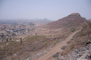
Hatgad Fort, near Mulher and almost on the edge of the Sahyadris, stands overlooking the Surgana taluka and the southern Dangs. It occupies a flat-topped hill which rises some 183 metres (600 feet) above the plain, and about 1,097.28 metres (3,600 feet) above sea-level. At its foot lies the village of Hatgad.
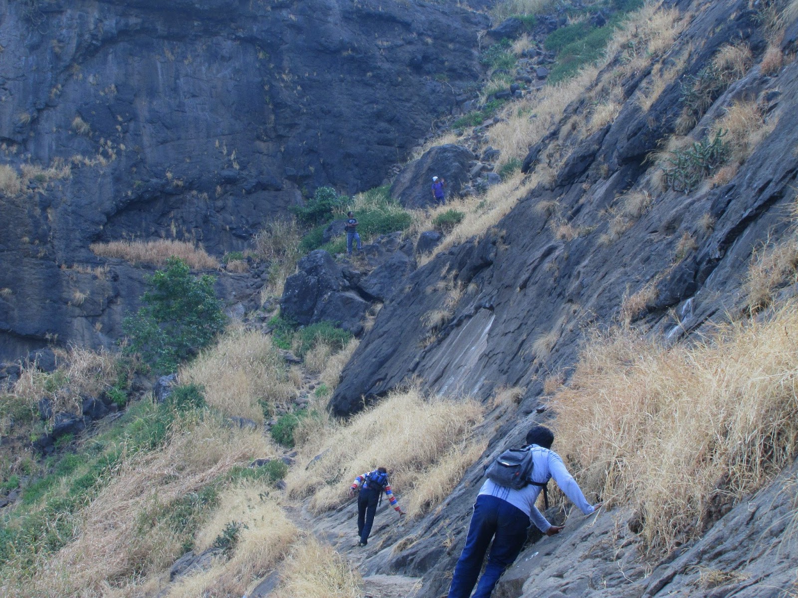
The ascent to the fort is through a narrow passage cut in the rock, provided with steps; It was defended by four gates which have fallen into ruins to-day. Most of the passage is roofed. Below the natural scarp the hill-side is pleasantly and thickly wooded. The path climbs through the woods, and, after passing under one or two small ruined gateways, enters the rock and runs underground for a few yards. As the natural scarp is not very perfect a masonry wall has been run completely round the upper plateau. The wall is now in disrepair.
Some pics....


Village:Hatgad, Block:Surgana, District:Nashik, State:Maharashtra, Country:India, Continent:Asia, Time Zone:IST ( UTC + 05:30), Currency:Indian Rupee ( INR ), Dialing Code:+91, Language:Marathi, Latitude:20.5390012, Longitude:73.7562437
No historical mention of Hatgad has been traced. The only local story is that in the time of Rangrav Aundhekar, the last officer who held the fort for the Peshva, one Supkarna Bhil came with a large following and laid siege to the fort. The siege continued for some time and was not raised until a shot from the garrison destroyed one of the Bhil guns. The Bhils then burnt the village and withdrew. In 1818 Captain Briggs, who visited the fort, reports that it was not more than 400 feet (121.92 metres) above the plain. Like other Nasik forts it had a perpendicular scarp of rock all round, and its want of height was more than made up by the strength of its gateways and the works connected with them. It had a wall all round which, though not very thick, was sufficient to give the garrison over from everything but large guns. There were five gateways in a large tunnel which traversed the rock as it ascended by steep steps. There was one small built bomb-proof filled with mortar for repairs to the fort. In the middle was a round tower which appeared much like a work but was only a deposit for grain.
Places of Interest
Two reservoirs, called Jamna and Ganga, are very deep and spacious, and contain a good supply of excellent drinking water throughout the year.
Hatgad Fort, near Mulher and almost on the edge of the Sahyadris, stands overlooking the Surgana taluka and the southern Dangs. It occupies a flat-topped hill which rises some 183 metres (600 feet) above the plain, and about 1,097.28 metres (3,600 feet) above sea-level. At its foot lies the village of Hatgad.
The ascent to the fort is through a narrow passage cut in the rock, provided with steps; It was defended by four gates which have fallen into ruins to-day. Most of the passage is roofed. Below the natural scarp the hill-side is pleasantly and thickly wooded. The path climbs through the woods, and, after passing under one or two small ruined gateways, enters the rock and runs underground for a few yards. As the natural scarp is not very perfect a masonry wall has been run completely round the upper plateau. The wall is now in disrepair.
Some pics....